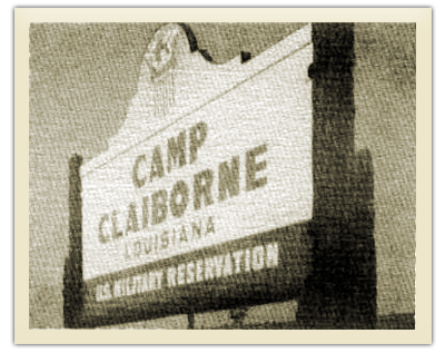
 : This World War II tent camp, initially called Camp Evangeline, was renamed for William C.C. Claiborne, the Governor of the Territory of Orleans and first governor of the State of Louisiana.
It was located in Rapides Parish on the west side of U.S. Highway 165 (at the intersection of Louisiana State Highway 112), about 17 miles southwest of Alexandria in the Evangeline District of the Kisatchie National Forest (established 10 Jun 1930), just north of Forest Hill, LA.
LOUISIANA STATE UNIVERSITY AT ALEXANDRIA ORAL RECORDS COLLECTION
Brigadier General Carlton Smith was interviewed by his granddaughter, Patricia Lavoner, in 1974. Smith was a major with the 634th Tank Destroyer Battalion at Camp Claiborne.
Patricia introduced her subject with this note: "General Smith toured the abandoned camp with me on April 8th, 1974, and pointed out the crumbled foundations which is all that remains of Claiborne build 34 years ago."
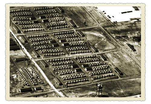
Smith told his granddaughter: "We arrived at the Camp Claiborne site in the fall of 1940. The camp area was under a complete construction program. Thousands of workmen from the area were building the temporary housing and utility buildings for the entire camp, which was expected to be used early in 1941. The area at that time consisted of 6,195 acres plus a large training and maneuver area, approximately 40 miles, extending west to Camp Polk. Much of this area was on a lease basis and was used only as a maneuver and training area."
"The camp site consisted of a tent area and many more or less permanent type structures that would last for an unknown period. The first troops arrived in January and February 1941.
They mainly consisted of the 34th Infantry Division from Iowa, Nebraska, Minnesota, and South Dakota, plus many other service units and engineers units were were to help in construction of the area."
"There is still evidence in the area where one can identify the actual sites where the troops were located, where the buildings were located, and the maneuver and training area."
"At the entrance of the camp area off of Highway 165, the stone and concrete columns still identify the old camp entrance."
"Shortly inside the old gates were the buildings used for vaults for the camp records and finance offices. This area was also used for construction headquarters during the time of the construction."
"Further in the camp you can identify the foundation, footings and columns of the old gymnasium and theater buildings. The service road through the center of the camp has now been improved and is the main route from Highway 165 to Leesville."
"The location of the old camp headquarters, the camp quartermaster, and the utility services for the camp can be identified by the footings, the walls, the remaining parts of the concrete buildings and by rows of concrete footings that extend above the ground. These can be easily identified for most of the buildings on the site."
"Although I know where the old hospital building was located, there is little evidence to indicate that it was ever there. The area has been reforested and has grown to cover this particular area. The hospital had been built for 1,656 beds and was located near the hill at the center of the camp."
"The roads for the camp still crisscross through the area. Most of these roads have been barricaded due to deterioration or salvage. The area roads still in use consist of the main road through the camp to Leesville and various service roads accessible to the areas around the camp. The entire camp area, still owned by the government, has been reforested and is now under the supervision of the U.S. Engineers" (U.S. Forest Service)
"As we stand here today and see the mute evidence of what was a part of World War II, we hope that the time will never come again when it will be necessary to rebuild Camp Claiborne, as it was an emergency project for World War II."
©2012 Ken Kopacki - San Antonio Web Design by Internet Direct. Site Materials Usage Policy Here.